Cyclones Hale and Gabrielle caused significant damage to Tairāwhiti’s land, infrastructure, economy and community. Many impacts are still being felt today and the continued vulnerability of communities and infrastructure to future weather events has been evidenced by further heavy rainfall events in June.
Recovery and resilience for Tairāwhiti
The priorities for recovery are to address the immediate needs of affected communities, repair and explore resilience options for damaged infrastructure and implement mitigation measures to reduce risks from future weather events. A recovery plan will focus on 4 key environments - built, natural, economic and social. For more information on the Tairāwhiti regional recovery
Recovery information and work
Advice and information, work underway and what's being planned for our region's recovery.


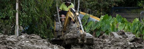


More information on silt and facilities
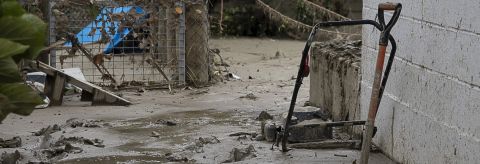
Seven reserves sustained severe damage that will require investment in repair and remediation before they're safe for community use.
A waterway restoration project of $1.5M is required to fence, plant and conduct predator control on the waterways that were damaged and on the reserves and facilities to aid in the prevention of damage from future weather events.
Burials at Taruheru Cemetery could not take place due to groundwater issues following the cyclone. A programme of repair and remediation is required to ensure that the cemetery, with over 20,000 internments, meets the community’s needs and safety requirements.
| Location | What is happening | Planned work |
|---|---|---|
| Anzac Park | Silt removal and remediation work is currently underway at Anzac Park. The area is closed as it is a work zone and there are numerous risks to the public. Remediation work is expected to continue until mid-June 2023. Alternative locations for walking your kuri include: On-leash areas:
Off-leash areas:
| Land remediation through silt removal, tree works, re-sowing grass areas to restore to a safe parkland setting. |
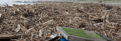
Doneraille Park | Closed to the public. Access is restricted due to bridge damage and there are significant volumes of silt and woody debris deposited on site. It is expected the site will be closed for at least two months. | Woody debris removal and re-sow of grass to restore to safe parkland setting. |
| De Costa Park | Re-grading and re-seeding of the reserve is needed so that grass can establish. We ask the public to refrain from moving waka or equipment out on to the reserve. Updates will be provided on reopening. | Silt removal and site remediation, re-seeding of grass. |
| Botanical Gardens Playground | During Cyclone Gabrielle the playground soft fall was washed away. The playground is closed until the soft fall can be replaced. Expected reopening mid-June. | Removal and replacement of contaminated soft fall and minor adjustments to play pieces. |
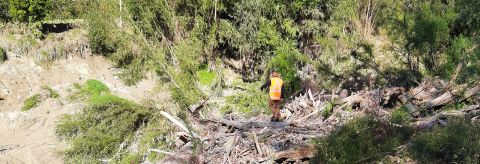
| Titirangi | Some tracks remain closed due to slips. Restoration work is being scoped. Please look out for signage on tracks. | Tree work and track maintenance. |
| Turanga Gardens | Gardens are closed as there are significant risks from falling debris around slips and potential fall risks due to sink holes. | Tree work and land stability improvements. |
Waka ama, kayaking and rowing are popular sports utilizing Anzac Park.
Anzac Park was inundated with silt from the Waimata River which caused large scale damage to water sports facilities and equipment. A proposed facility that is flood-resilient, safe and located outside the flood zone is proposed at a cost of $8.4M as part of a resilience package that recognises the link between community connection and physical and mental wellbeing. Coordination is necessary to ensure a dig-once approach is achieved.
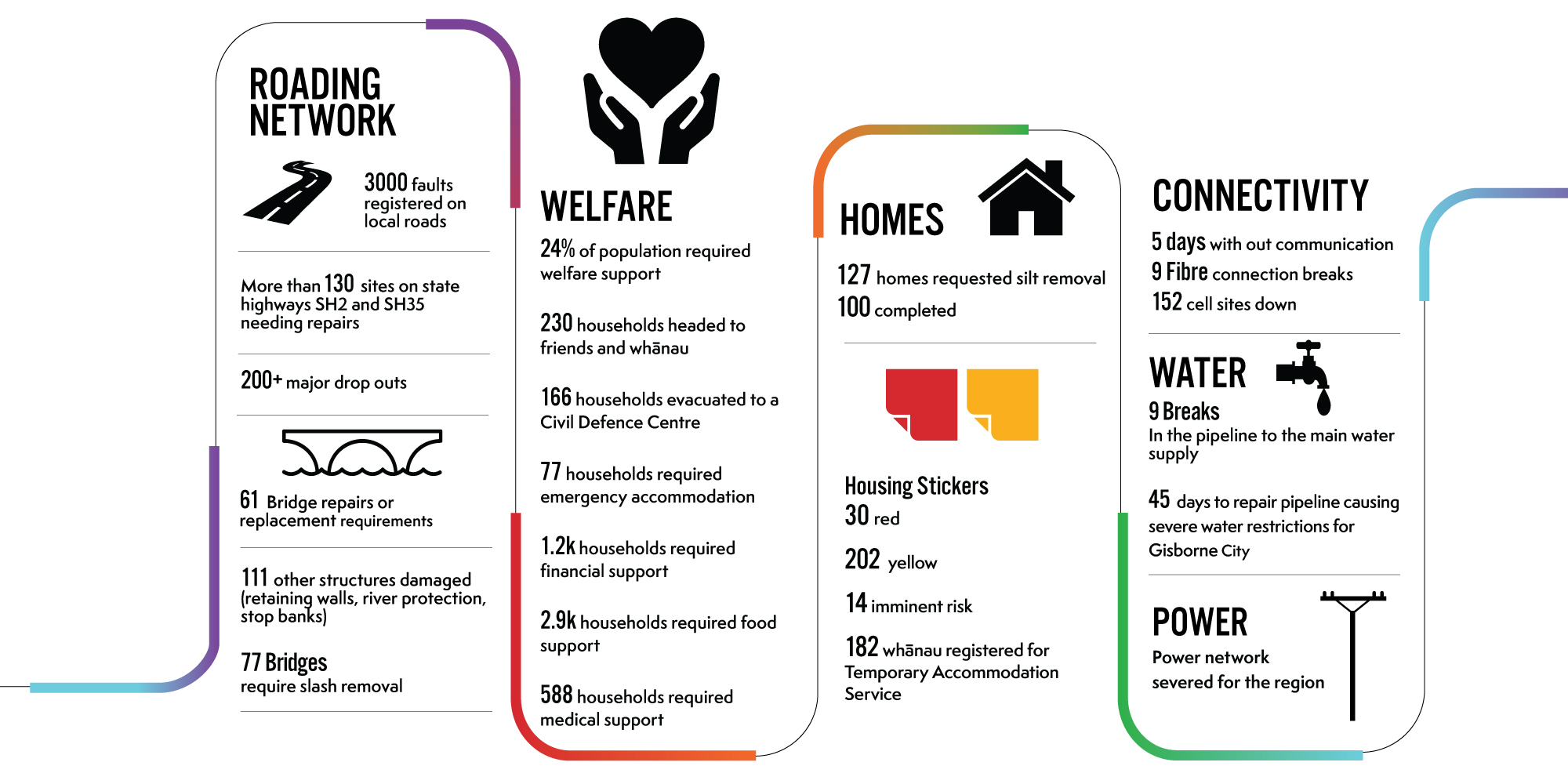
Details of the impact of Cyclone Gabrielle across our region
A local state of emergency was declared at 9.45am on Monday 13 February. That was superseded by a national state of emergency at 8.45am Tuesday 14 February.
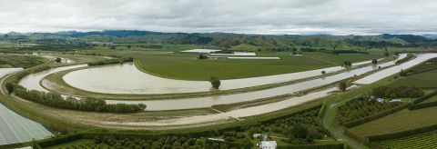
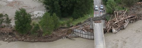
The most severe weather impacted Tairāwhiti on Monday 13 February through to Tuesday 14 February then reduced intensity. It caused widespread damage to roads and infrastructure, homes and businesses across the region.
The national state of emergency over Tairāwhiti ended 14 March
The damage and impact of Gabrielle compounded with the adverse impacts of Cyclone Hale on 10 January and previous severe weather events since March 2022.
Tairāwhiti has been in an on going state of recovery as a result of 9 significant storms since June 2021.
Civil Defence timeline of key milestones, decision and coordination efforts
A timeline of the key milestones, decisions and coordination efforts of Tairāwhiti Civil Defence Emergency Management and the agencies and partners between 4 - 19 February 2023.
At the peak of the event, rivers across the region peaked at:
- Waipaoa River 12.8m
- Waiapu River 8m - the highest level recorded since 1975
- Te Arai River 4.9m - the highest recorded since 1983
- Hikuwai River 14m - in 1988 Cyclone Bola, the level was 14.3m
Rainfall over Monday and Tuesday 14 February:
- 547mm Raparapaririki, Waiapu
- 500mm Mangapoike, Waingake.
Power and fibre optic connection was lost for 5 days - this meant no broadband internet and cellphone service, causing Eftpos and ATM machines to go offline.
Both state highways 2 and 35 into the district were closed.