Following the impacts of Cyclone Gabrielle in February 2023, flood resilience options have been investigated for the Te Ārai catchment.
This project focuses on identifying cost-effective solutions to reduce the likelihood of repeat damage from similar flood events. Technical investigations, engagement with mana whenua and the community and evaluation of a wide range of flood mitigation options have helped identify a preferred approach for the catchment.
10 homes within the catchment were classified as Category 2 under the Future of Severely Affected Land (FOSAL) framework. Cyclone Gabrielle also caused significant impacts to horticultural and cropping land across the catchment.
Te Ārai preferred option report
The Te Ārai Preferred Option Report identifies a preferred programme of works to help reduce flood risk in the Te Ārai catchment.
Following technical assessments and engagement with the community and mana whenua, the recommended approach focuses on non-structural measures, including channel maintenance, nature-based solutions, monitoring, planning controls, improved flood warning systems, emergency management planning and community education.
The programme aims to reduce risk to people and property while supporting long-term community resilience. The report also outlines the flood hazards affecting the area, the options considered, stakeholder feedback, technical assessments and the rationale for the preferred programme of works.
No results found for ""
Next steps
This is a complex project and will require further assessment before any decision is made to proceed. A cost-benefit analysis will be completed before Stage 2 approval is considered. Any proposed works will also consider protection of the state hghway, along with surrounding land, homes and other property.
Te Ārai catchment
Manutuke
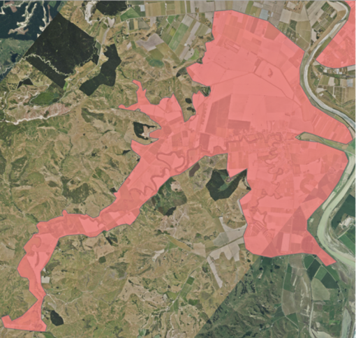
The Te Ārai catchment covers an area of 3,131 hectares, with around 300 homes located within the flood resilience investigation area, shown by the red overlay on the map.
This project aims to reduce flood risk to people, homes community facilities and evacuation routes.