Our local road network remains fragile
We're carrying out both ongoing maintenance and significant recovery work across the region.
The table and map below shows road closures and restrictions.
To view the full programme of road works, see the webpage Maintenance and Recovery Work
Temporary road closures and restrictions
Mainly weather-related
| Road |
Location |
Status |
Comments |
Update / Reopen ETA |
Updated |
Photos |
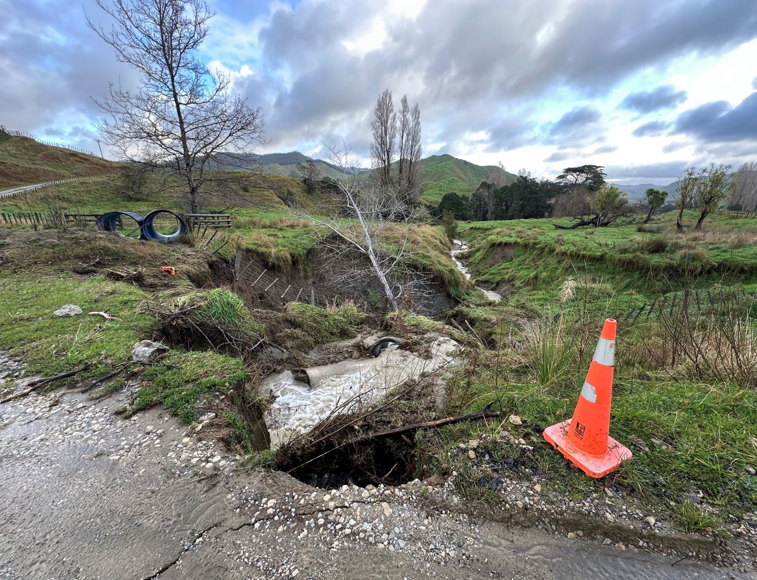
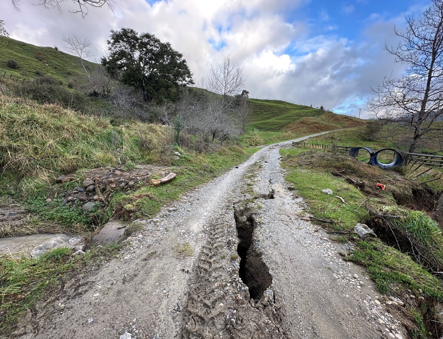
| Matokitoki Valley Road |
2.966 km |
1Closed
|
Planned Dropout Repairs - Residents and Service vehicles access only |
24 Jul 2026 12:00pm
|
13 May 2026 1:30pm |
|
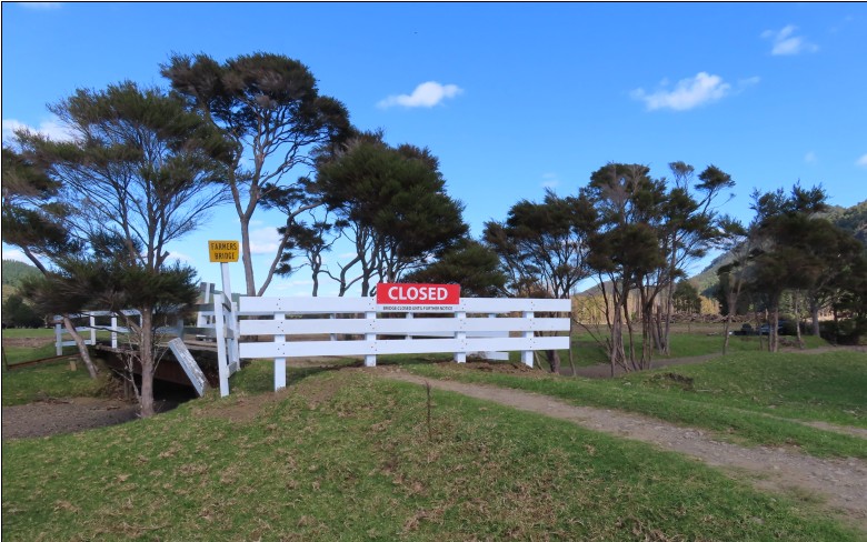
| Tokata Road |
1.43 km |
1Closed
|
Farmer Bridge closed due to scouring |
To be advised
|
15 May 2026 10:27am |
|
| Kiore Road |
2 km |
3Closed to Heavy Vehicles
|
Dropout |
To be advised
|
02 Jul 2026 7:56am |
|
| Tauwhareparae Road |
Tauwhapareparae & Tuahu intersection |
34WD Access Only
|
Slip caution, delays expected |
Next update
17 Jul
|
15 Jul 2026 2:26pm |
|
| Bushy Knoll Road |
27 - 47 km |
1Closed
|
Multiple trees down on powerlines - Resident Access only |
Next update
17 Jul
|
13 Jul 2026 12:55pm |
|
| Monck Road |
1.2 km |
1Closed
|
Culvert washout - Resident Access only |
Next update
17 Jul
|
13 Jul 2026 12:52pm |
|
| Utting Road |
entire road |
1Closed
|
Large Slip - Resident access only |
Next update
17 Jul
|
13 Jul 2026 12:45pm |
|
| Titirangi Drive |
entire road including Queens Drive |
1Closed
|
Planned works - Fence repair from Tuesday 14/07 until Wednesday 15/07 from 7am to 4:30pm (open to pedestrian) |
15 Jul 2026 4:30pm
|
13 Jul 2026 12:18pm |
|
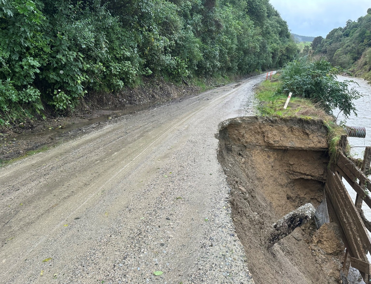
| Waiomoko Road |
near the end at Williams Bridge |
1Closed
|
Bridge abutment washout |
To be advised
|
13 Jul 2026 3:45pm |
|
| Motu Road |
32.681km |
1Closed
|
Slip - refer to Opotiki District Council Website |
Next update
18 Sep
|
10 Jun 2026 4:21pm |
|
| Walker Road |
Walker Rd Bridge |
3Closed to Heavy Vehicles
|
Washout on Abutment approach; TMP in place, alternative route to bypass this site. |
Next update
18 Sep
|
02 Mar 2026 2:19pm |
|
Map display of road information
The map displays long-term road closures and works on state highways. For more detail, visit NZTA Waka Kotahi
Report road or bridge issues
To report local road or bridge issues, please use the Antenno app or contact us online
Antenno
The quickest way to report issues is through Antenno. The app lets you send reports straight from your phone and receive instant updates on main road closures. Download Antenno today
