Friday 10 May 2023
A lake that formed in Tairāwhiti last year has its days numbered.
The lake, named Rototaupua by Tikapa Beach resident Graeme Atkins, means temporary lake and it’s living up to its name.
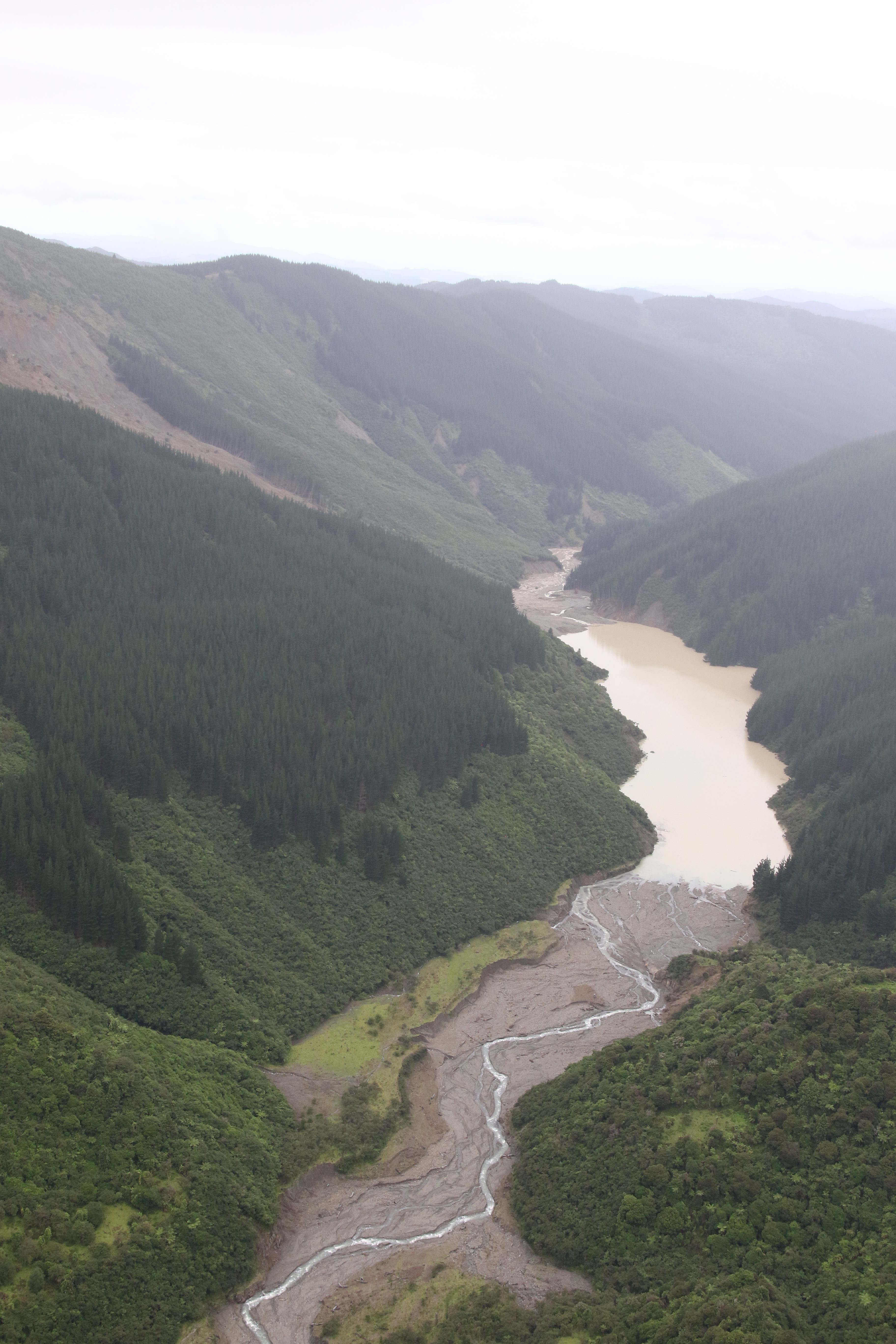
A satellite flyover in March this year showed water was draining from it rapidly and it’s likely to be gone by the end of winter, if not before.
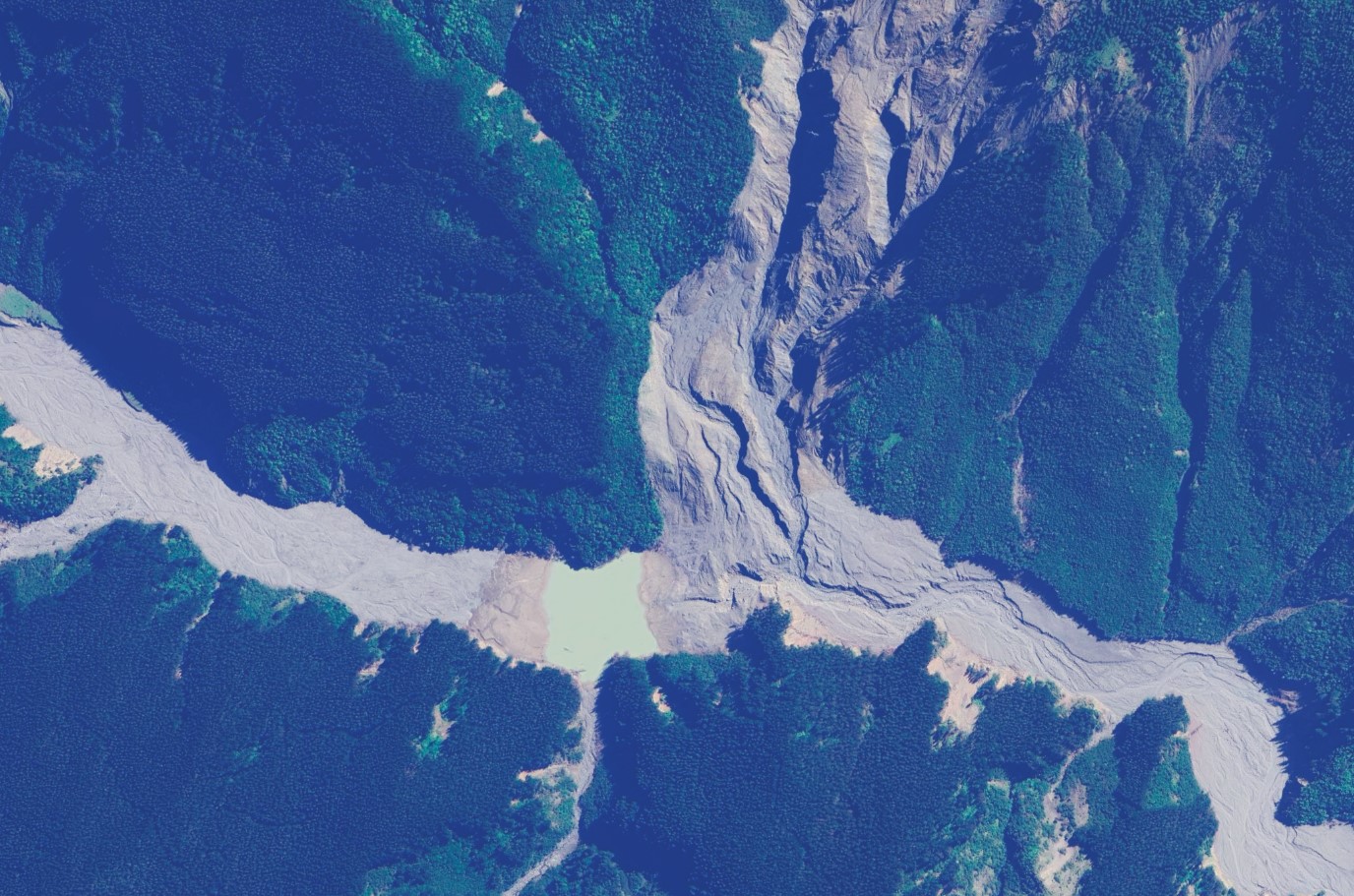
During the March 2022 storm event in this region, a landslide occurred in the upper Waiorongomai Valley partially blocking the Waiorongomai River, inland from Ruatorea.
On 12th January 2023 Gisborne District Council became aware that a lake had formed as a result of further landslide movement during Cyclone Hale, when a forest manager for Summit Forests reported the landslide dam to Tairāwhiti Emergency Management Office (TEMO).
The possible risk to downstream infrastructure and residents was flagged and Councils’ Principal Scientist Dr Murry Cave notified both GNS and landslide specialists at Auckland University the same day.
“Because of the possible risk to life downstream a helicopter flight was undertaken the following day to assess the size and stability of the landslide dam.
“Flying conditions were difficult and so landing on the landslide dam was not feasible but arrangements were made to mobilise a response team from GNS as soon as possible to assist with an assessment of the risks the landslide dam and the build-up of water behind it posed to the community and infrastructure downstream.”
Analysis of the valley using LiDAR flown in May 2022, and again in June 2022, by Dr Jon Tunicliffe of Auckland University indicated that the valley had been partially blocked before Cyclone Hale.
Dr Cave said this indicated the initial landslide failure occurred during the March 2022 severe storm which partially blocked the valley.
That same storm resulted in more than 38,000 landslides in the Gisborne/Tairawhiti region.
“As Dr Tunicliffe noted, it would not have taken much to fully block the river after the March 2022 landslide.”
A GNS landslide team assisted Council in undertaking a risk assessment of the lake on February 8, 2023, and reported back two days later to show what the inundation levels would be if the dam did burst.
Dr Cave has continued to monitor the area and a new high-resolution aerial imagery was used to map it in November 2023.
“This shows that the lake behind the landslide dam is gradually diminishing in size, and it’s anticipated that the lake will have fully drained by the end of winter.”
Dr Cave noted that while it would be nice if the Tairāwhiti region had a new permanent lake, in this case, it is expected that the lake will have completely gone within the next few months.
“This is also the case with most other storm-induced landslides in recent years including that on Tauwhareparae Road, at Matanui and in the Aorangiwai River."
Above shows the landslide dam, and new lake, in February 2023.
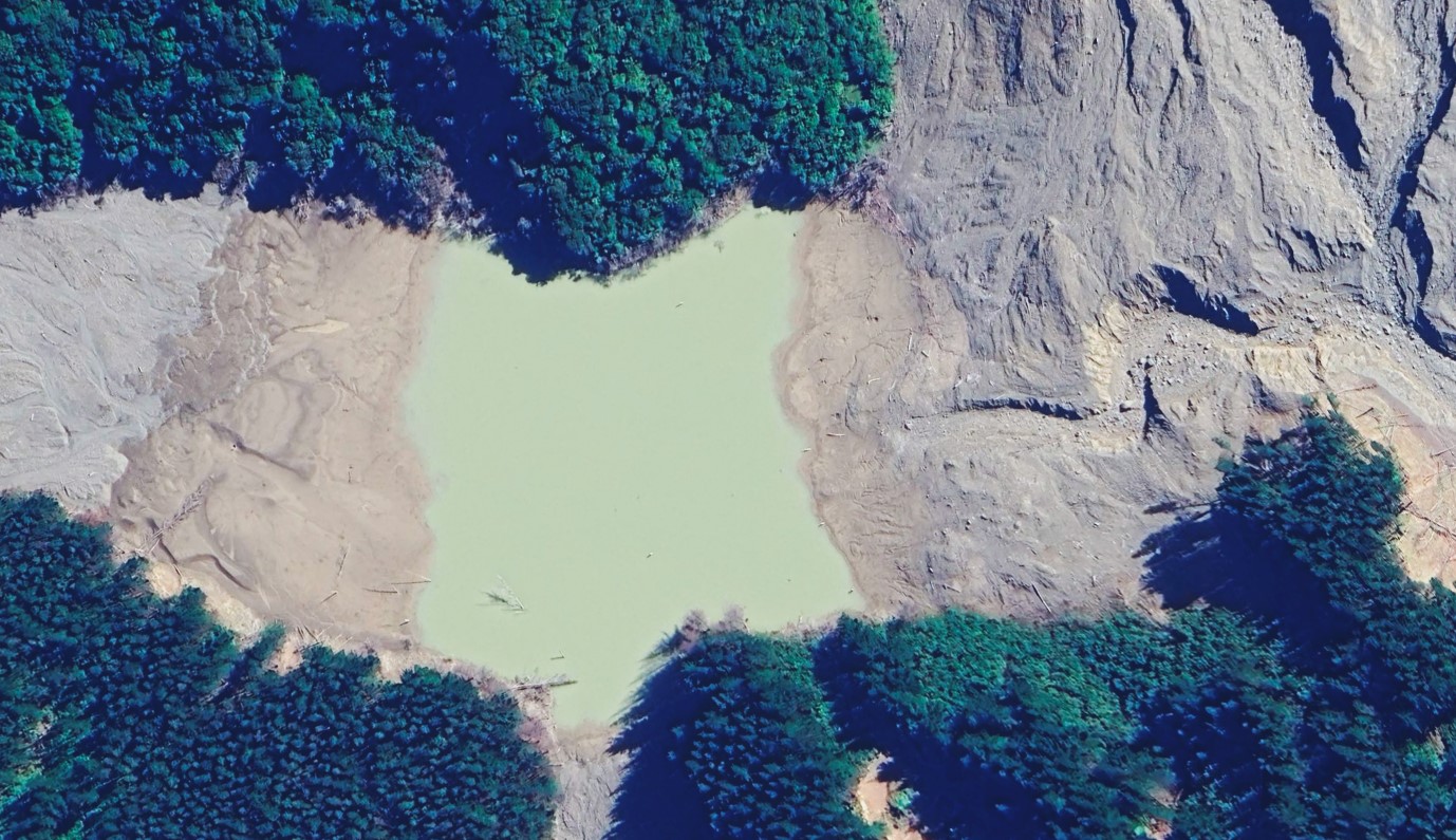
Below is the lake in imagery from November 2023.
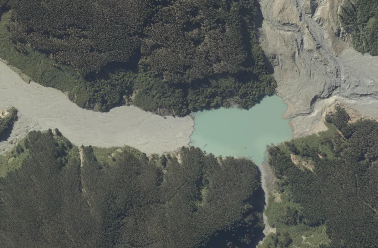
The below satellite imagery dated 24th March 2024 shows the lake has continued to reduce in size.
Assessment of the March 2024 image suggests a relatively rapid evacuation of water at some stage not long before the image was acquired as shown by the still wet shoreline.