In 2020, the government declared a climate change emergency, recognising the need for us all to prepare for the impacts of a warming climate - including more erosion, more flash floods and wildfires in our region. Climate change is the most significant long-term issue facing our communities. We’re expecting sea level rise, coastal erosion and more frequent flooding that will affect homes, recreation areas and infrastructure.
We need strong flood protection to keep our people and communities safe when rivers break their banks during heavy rains. We also need to protect our region's vital horticulture, viticulture and farming assets from the growing impacts of climate change.
That's why we're accelerating delivery of the Waipaoa Flood Control Climate Change Resilience project - to provide the greater level of protection our community needs, and to safeguard both economic development and wellbeing for the future.
Increasing flood protection for Poverty Bay floodplains and Gisborne city
The aim of this project is to increase the level of flood protection provided by the Waipaoa Flood Control Scheme (WFCS) to a 1-in-100-year return period, accounting for climate change effects through to the year 2090.
The WFCS includes approximately 64km of stopbanks along the Waipaoa River, along with other river control structures and protection works (such as pipes and floodgates). These were originally constructed between 1953 and 1967 to protect the Poverty Bay floodplains and Gisborne city.
Resource consent for stopbank improvement work was granted on 26 October 2018, with construction beginning in February 2019.
Originally designed in 1949 and built between 1953 and 1969, the WFCS is considered one of Council’s most valuable assets. It protects around 10,000 hectares of highly productive floodplain land.
The current upgrade programme, which began in 2019, involves strengthening and improving approximately 64km of stopbanks along the Waipaoa River. It is now expected to be completed by June 2027 - 4 years ahead of the original 2030/31 schedule.
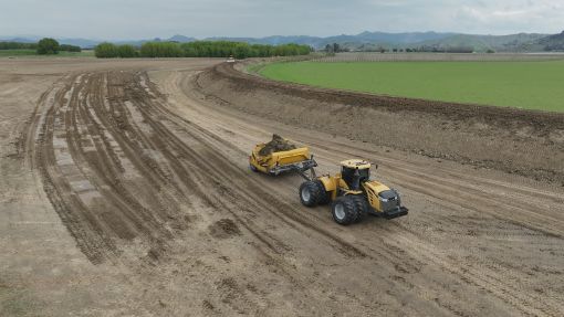
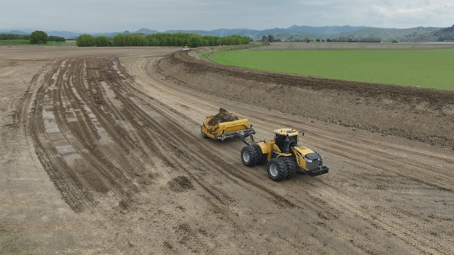
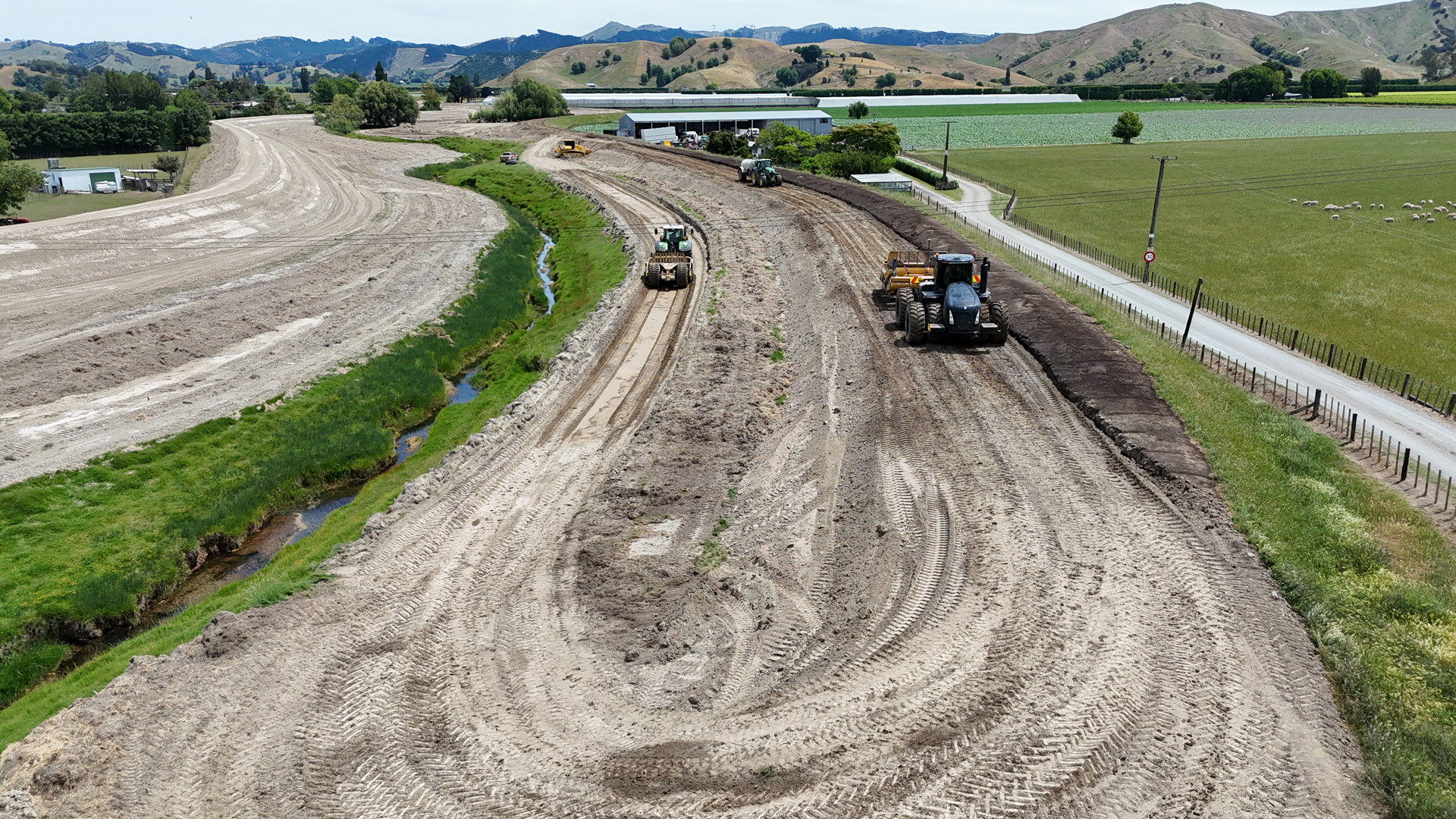
Stopbank work
As part of the upgrade, stopbanks are being made both higher and wider. The top crest width is being increased from 1.5 metres to 4 metres, and in some areas, stopbank heights are being raised by 1–2 metres.
Experts have advised that these improvements are necessary to provide the full level of protection required for the region.
Project budget and progress update
2024-2027 Three Year Plan $10.1million
External government funding $20.46 million (approved Dec 2023)
Started: 2015/16
Revised completion date: June 2027
Overall progress: We're just over 83% through the upgrade, based on the total length of stopbank improvements.
Approx 52km of stopbank raising and widening completed to date.
Upcoming upgrade work
In August 2020, we received $7.5m in external funding support by Kanoa to accelerate the delivery phase of the stopbank upgrade project. This support significantly reduces the financial contribution required from our community.
In December 2023, the government approved an additional $20.46m, further strengthening our ability to deliver this critical flood protection work.
| Date planned | Stopbank location |
|---|---|
| Sept 2025 | Upgrade near Patutahi and Waituhi - approx 2km remaining |
| Oct onwards | Final 6km of stopbank, to begin near Kaitaratahi Bridge (western side) |
| Oct 2025 – Dec 2025 | Upgrade remaining Waituhi area up to 678 Lavenham Road - 1.5km |
| Oct 2025 - June 2026 | Upgrade between 1053 Lavenham Road and 1913 Matawai Road - 6.5km |
| March - May 2026 | Install 'flood door' across KiwiRail low point near ocean |
| Oct 2026 - June 2027 | Rock armouring works at multiple locations across the WFCS |
| June 2027 | Waipaoa Flood Control Scheme fully upgraded and operational on both sides |
Total project cost estimate - $35-37 million (approx)
Stopbank upgrades
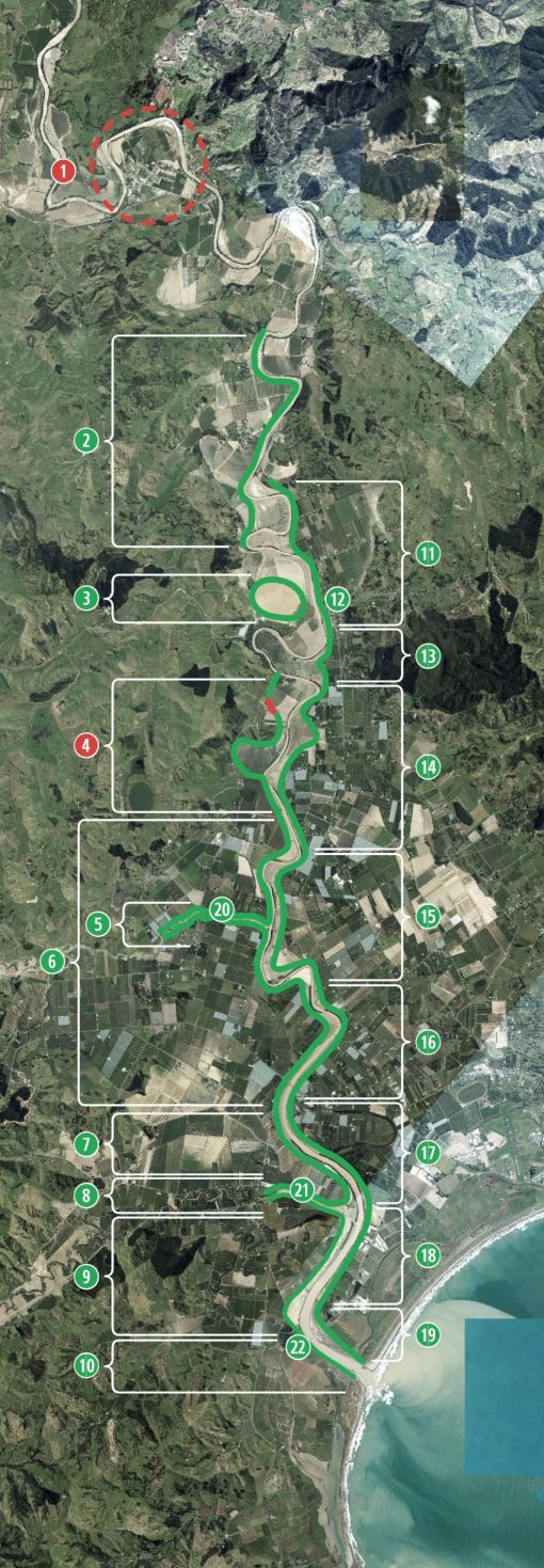
Key to the map
1. Te Karaka Flood Resilience Project - hydraulic modelling, detailed design, consenting, implementation ongoing
2. Wi Pere to 1913 Matawai Rd, 6km - completed June 2026
3. Wi Pere Trust mitigation measures, completed Dec 2022
4. Renner Rd to 678 Lavenham Rd 4.6km completed. Final 300m expect to complete Oct 2026
5. Whakaahu Stream, upstream of Lavenham Bridge 1.7km, completed Dec 2024
6. Matawhero Bridge to Lavenham Rd Bridge, north side Whakaahu Stream, 1.7km upstream. 12km completed Nov 2024
7. Opou Rd to Matawhero Bridge (SH2) 3.4km, completed Nov 2023
8. Te Arai River, both sides 4.5km, completed January 2023
9. Railway Bridge to Te Arai 3.2km, completed Dec 2022
10. Railway Bridge to ocean, completed Jan 2024
11. Kaitaratahi Hill to Whitmore Rd, 3km completed April 2022
12. Mahunga Stream floodgate construction, completed Jan 2024
13. Caesar Rd to Whitmore Rd 1.5km, completed Jan 2024
14. Ceasar Rd to Ferry/Ingram Rds 4.7km, completed Oct 2019
15. 359 Bushmere Rd to Ferry/Ingram Rds 4.7km, completed Feb 2022
16. Matawhero Bridge to 359 Bushmere Rd 3km, completed June 2021
17. Willows/Dunstan intersection to Matawhero Bridge 3.8km, completed March 2021
18. Railway Bridge to Willows/Dunstan 2km, completed Feb 2020
19. River mouth to Dunstan Rd 2km, completed Dec 2020
20. Whakaahu culvert completed January 2026
21. Whatatuna flood gate completed March 2026
22. Railway Bridge swing gate install completed May 2026
| Date completed | Stopbank location - km completed |
|---|---|
| April 2025 | Whakaahu Stream confluence up to Waituhi - 6km |
| April 2025 | Both sides of river upstream of Lavenham Bridge - 3km |
| May 2024 | Matawhero Bridge to Lavenham Road Bridge, including north side of Whakaahu Stream - 10km |
| November 2023 | Between Opou Road to Whatatuna Floodgate fully upgraded - 2.2km |
| February 2023 | Downstream from Opou Road to Whatatuna Floodgate fully upgraded - 2.2km |
| December 2022 | Between Waipaoa River mouth and Te Arai Stream (western side) except remaining 200m - 8.5km |
| April 2022 | Between Whitmore Road and Kaitaratahi Hill – 3km |
| March 2022 | Between Ford and Caesar Roads – 1km |
| February 2022 | Upstream of Matawhero SH2 bridge along eastern side to Ferry Road – 4.5km |
| May 2021 | Upstream of Matawhero SH2 bridge - 3km |
| March 2021 | Railway Bridge and Matawhero SH2 Bridge - 4km |
| December 2020 | Waipaoa River Mouth and Railway Bridge – 2km |
| February 2020 | Railway Bridge near Waipaoa river mouth – 2km |
| December 2019 | Between Bruce and Ferry roads - 2km |
| February 2019 | Between Ford and Bruce roads - 2.1km |
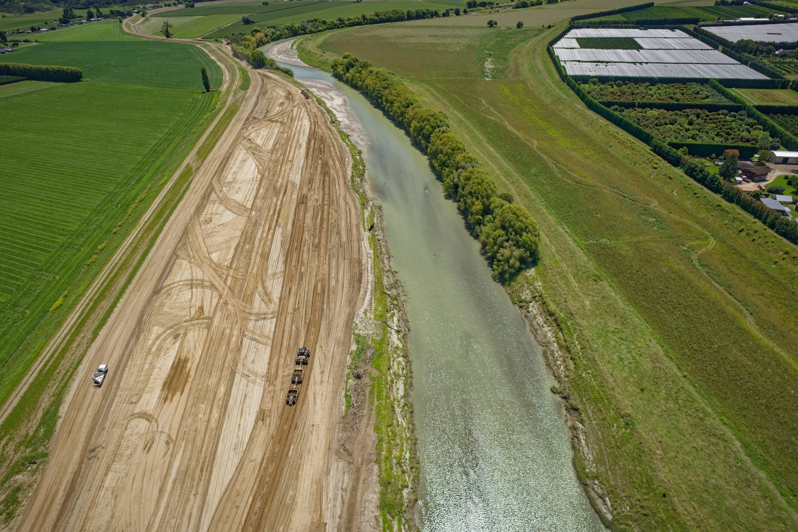
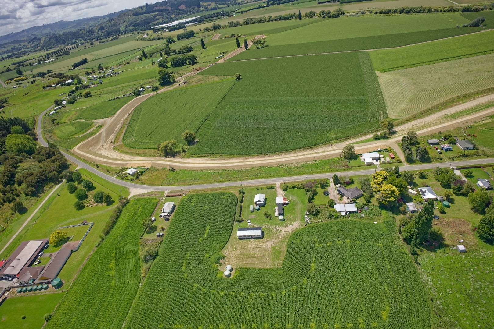
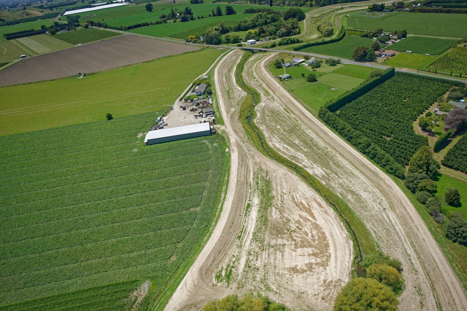
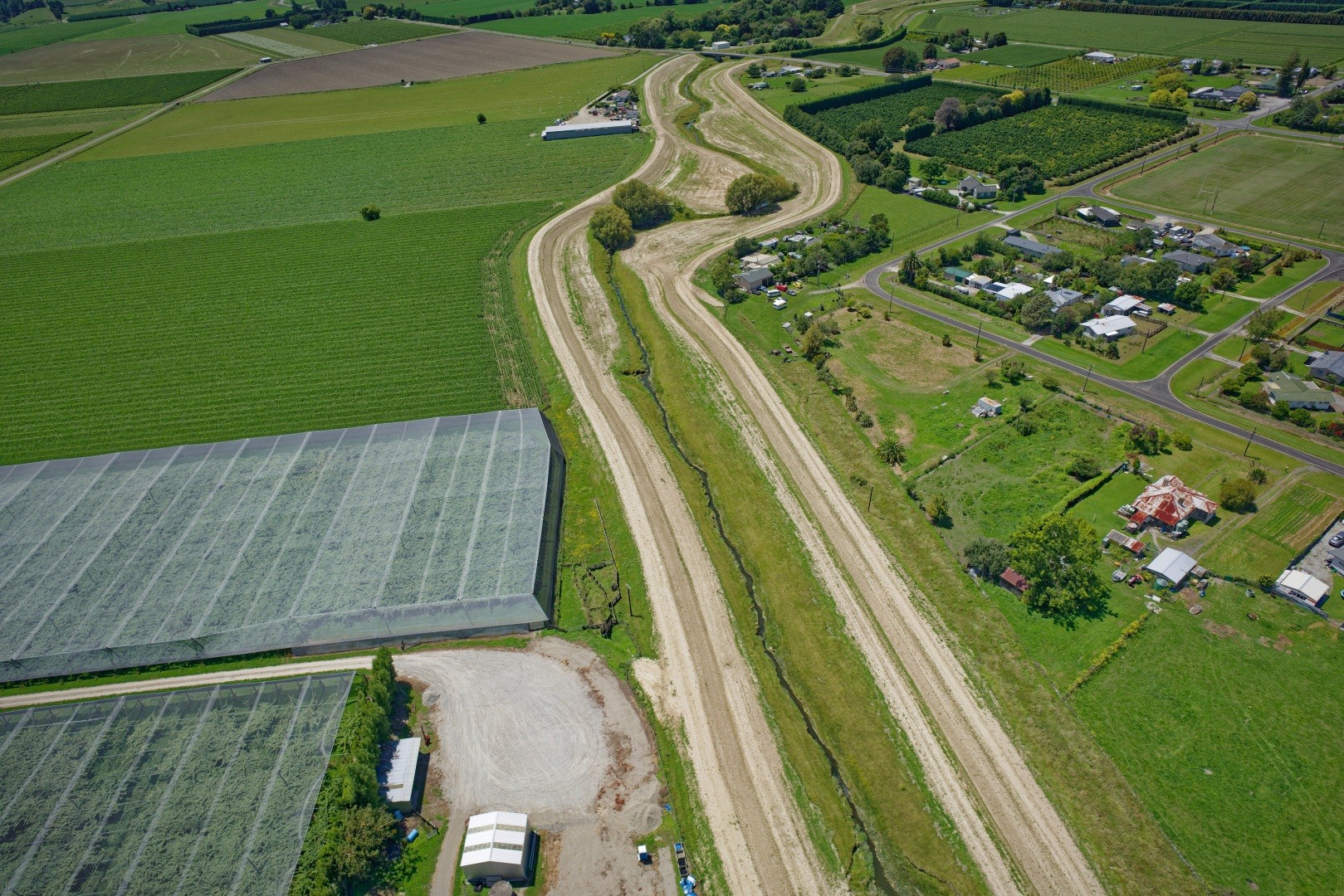
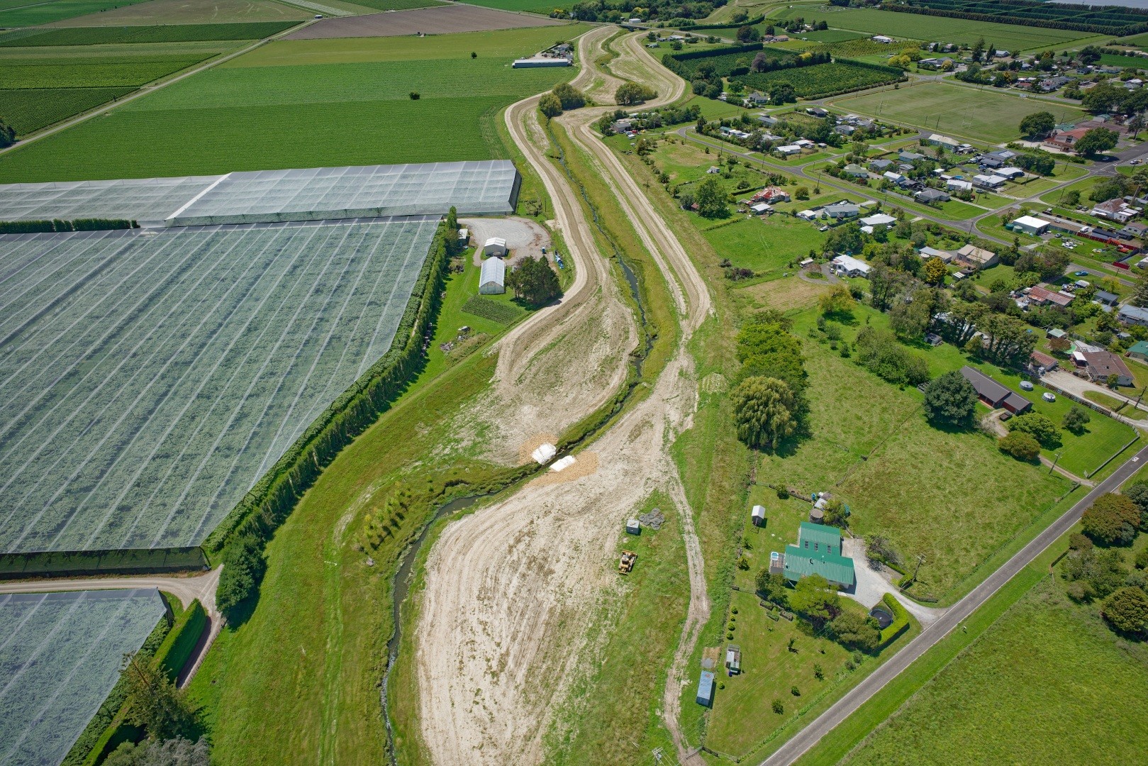
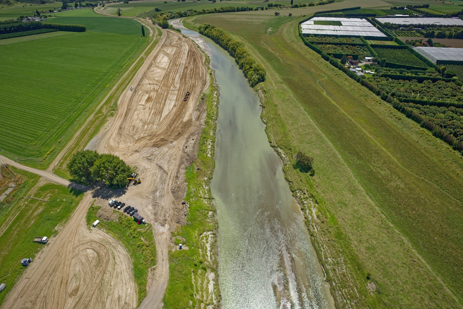
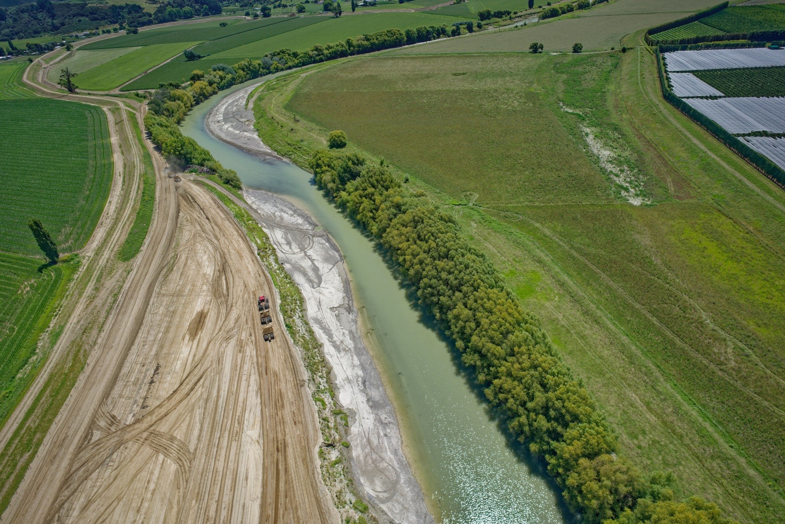
Photos of stopbank works
Frequently asked questions about the upgrade
It might seem like dredging could help, but it’s not a viable long-term solution for the Waipaoa River.
The catchment delivers huge volumes of sediment from unstable hill country, which quickly fills up any dredged areas, wiping out short-term gains.
Dredging would require removing millions of tonnes of gravel, which is costly, low quality and unsuitable for reuse in stopbanks. It also faces environmental and regulatory constraints and government funding for this project is limited to capital upgrades not ongoing maintenance like dredging.
Instead, upgrading stopbanks provides a more sustainable and effective way to reduce flood risk.
Information for property owners along the Waipaoa River stopbank upgrades
The Waipaoa flood control climate change resilience project will:
- Upgrade the existing flood control scheme to a 100-year design event including for climate change factors out to the year 2090.
- Improve resilience against flood events.
- Protect and improve council’s most valuable asset.
- Continue to protect the 10,000 hectares of fertile floodplain land. This scheme protects and supports the high yield horticultural uses.
Earth fill material is required for the scheme upgrade. This will be sourced from a number of borrow sites located within the section that's being worked on each year. This is typically the flat floodable berm areas located between the stopbank and the river.
There'll be increased earthworks at these sites as borrow material is excavated and moved to the section of the stopbank that's being upgraded.
All borrow sites will be reinstated when construction is completed.
You may notice truck movements and noise from earthworks during construction.
You may also notice increased activity on sections of the scheme not under construction, as investigation and planning for subsequent construction phases is undertaken.
As the upgrades are completed, the stopbank will be re-sown with grass.
The upgrade work will generally be done during summer months when river flows are low and when there's favourable ground conditions.
Because the upgrade will affect parts of the flood control scheme as they're worked on, they'll be managed in limited sections at a time, to manage any potential flood risk.
If contractors require access to your property, we'll contact you.
Where access is required to part of your property, a clearly defined area of entry will be agreed with you prior to any entry.
The area required for access will be clearly shown on a plan and the term of access required clearly set out.
If you have a licence for any areas of the existing scheme which are being upgraded, you'll be contacted.
The timing of construction on any licenced area will be determined well in advance, so that any crop can be harvested and future plans made by the licensee.
There may be a reduction in the licence fee for any loss of use during the works. Once construction is completed, any changes to the licence will be discussed and a new license issued.
There's no cost to the property owner or occupier for the work.
Those who wish to take advantage of reinstatement works and upgrade infrastructure such as fences may be able to pay the difference, assessed on a case-by-case basis.
Any part of your property damaged by entry will be reinstated as close to its original condition as possible by the contractor on completion of the works.
Where the work affects an existing boundary fence, a temporary fence will be provided by the contractor to ensure any stock is kept secure.
Once construction's finished, the fence will be fully reinstated by the contractor.
We'll notify landowners who have a water take that crosses the stopbank about the timing of the work.
The work will be managed to minimise disruption to the water supply during construction.
The contractor is required to manage dust and noise during the physical work.
Once construction's completed, the stopbank will be re-sown with grass.
Noise will be limited to earthworks machinery during construction.
Borrow sites for fill material to build the stopbanks will be selected to have the least environmental impact on river ecology, fish passage and spawning.
Cultural and archaeological discovery protocols have also been set up as part of the resource consent process in advance of construction occurring.
Work times will typically be:
- Monday - Friday 6am-6pm
- Saturday - 7am-1pm
There will be no work on public holidays.
An 8km long cycle trail was completed in June 2022 between the Waipaoa River mouth and the Matawhero SH2 Bridge on the eastern side of the Waipaoa River.
The resource consent for the cycle trail only covered this specific area.
There's currently no approved resource consent for a cycle trail along any other stopbank.
Resource consent for the construction of any additional cycle trails along the Waipaoa stopbanks will be applied for on a case-by-case basis for specific sections as they are required.
Council will consult with landowners and stakeholders as these cycle trail options are investigated and considered.