19 December 2025
Council has significantly upgraded its flood intelligence systems, strengthening its ability to anticipate flooding and support improved decision-making for communities across the district.
Tim Barry, Director Community Lifelines, says the completion of these upgrades marks a major milestone in the region's recovery programme.
"These upgrades provide an improved information platform to predict, prepare for and respond to severe weather events.
"Improved intelligence can improve the quality of decision-making in the moments that matter."
The $1.45 million project was funded through $1.2m of cyclone recovery funding from Central Government, with Council contributing $250,000.
At the centre of the upgrade is a new flood forecasting system developed by Jeremy Benn Pacific (JBP).
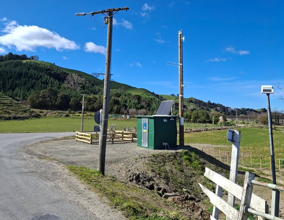
The system brings together weather forecasts, river and rainfall data from Council’s 59 monitoring sites, and information from neighbouring regions into one place.
This allows forecasting officers to track storms in real time, compare multiple weather forecasts at once and provide clearer, more reliable information to Civil Defence and Emergency Management (CDEM) teams ahead of weather events.
Project Lead Divesh Mistry explains that this shift represents a step-change in regional flood forecasting.
“For the first time, we have a forecasting system that pulls in data from across the motu, not just within our boundary.
That gives our teams a clearer, earlier picture of how storms are tracking toward Tairāwhiti.”
Government funding has also improved resilience of the wider flood intelligence network through installing new monitoring stations at vulnerable sites, modernising the communications network after lightning damage and installing five ‘smart’ groundwater bores to help manage urban flooding risks.
“This isn’t just new software—it’s a full system upgrade,” Mistry says. “We’ve built a network that’s far more robust and far better equipped to withstand future events.”
The project has been a collective effort across the motu, with Greater Wellington, Horizons and Northland regional councils providing support to align systems nationally.
Following a presentation on Tairāwhiti's system at the National Flood Symposium this year, South Island councils are now moving toward the same platform.
“This mahi is helping Aotearoa move toward a common operating system for flood intelligence,” Mistry says.
“It aligns with national recommendations following the public inquiry into the North Island Severe Weather Events and ensures regions can work together more effectively in the face of severe weather.”
Image: New monitoring station installed at Kanakanaia Bridge Te Karaka, after the previous site was damaged in Cyclone Gabrielle