03/08/2023
Council are asking growers on the Poverty Bay and Uawa Flats to complete a survey about good management practice.
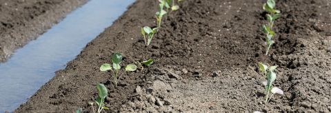
The information from this survey will be used to model estimated nutrient losses from the various land use and soil types across the flats.
Council manages water quality within rivers through catchment plans. These identify specific areas of land use known as Freshwater Management Units, or FMUs.
Jo Noble, Director of Council’s Sustainable Futures’ Hub says the FMUs are an essential tool in freshwater management.
“FMUs allow Council to manage the water quality in the context of specific land use.”
“The predominant land use within these areas is irrigated horticulture, vegetable cropping and occasional grazing as part of the crop rotation cycle.”
“Over the past few years monitoring in the Poverty Bay Flats FMU, and the Uawa Flats has shown a trend of deterioration.
“This assessment will better our understanding of nutrient dynamics and land management practices on farms and orchards in these areas.”
The survey closes 31 August. All responses are confidential and no personal details will be released. All responses go directly to Plant & Food Research.
All catchment plans, including the FMUs, are being reviewed over the next two years as part of Council’s freshwater projects of the Tairāwhiti Resource Management Plan review.
Link to crop surveys