March 2, 2022.
Soil Quality Monitoring
Council’s Environmental Science and Integrated Catchments teams are establishing a continuous Soil Quality Monitoring Programme at sites throughout our region over the next five years.
The Soil Quality Monitoring Programme seeks to gain an understanding of the current quality of our soils under various land uses and determine how these land uses are affecting soil quality over time.
What is Soil Quality Monitoring?
Soil quality monitoring acts as an early warning system. It allows us to identify any negative effects of different land uses. It also allows us to track specifically identified issues relating to the effects of primary land uses on long-term soil productivity, for example, the amount of nitrogen available for plants to take up.
Monitoring will allow us to understand the current state of our soils, how this relates or varies under different land use, and how soil health changes over time. This programme will allow us to determine region-wide trends.
Tairāwhiti’s soil monitoring results will be integrated with other councils’ results to develop a further understanding of the country’s soils.
Tairāwhiti has some of the most elite soils in the country; however, without monitoring them, we do not know what condition they are in.
Why are we undertaking Soil Quality Monitoring?
Soil monitoring is a national requirement under the Resource Management Act (1991).
It will provide useful information for the proposed National Policy Statement for Highly Productive Land. The information gathered will help provide input into future regional policy development.
Soil monitoring results can be used to better understand surface and groundwater quality (such as the effect on water chemistry), as we know what we do on the land affects what happens to our water. This information will be used in the development of Freshwater Catchment Plans (a requirement under the National Policy Statement for Freshwater Management (2020)).
The evidence will also be beneficial for land-use initiatives and land management improvements.
The intention of this programme is to build up a knowledge base on the health and quality of our soils, rather than for regulatory enforcement.
What will be involved?
- Identify a number of sites to monitor within each land use type, using the Land Use Capability Classification (LUC). This ensures there is a representation of the region’s soils and land types.
- Work with landowners to obtain access and ascertain current and historic land uses.
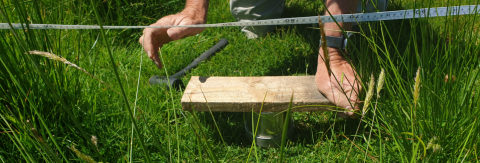
- Establish each monitoring site and collect samples to be analysed at a laboratory.
- Record an indicative measure of current soil quality for each site by seeing if the laboratory results fall within nationally set target ranges for each indicator.
Values that fall above or below a target range can limit production from the soil or indicate negative effects on the wider environment.
- Sort data from all sites by land use to determine the soil quality under each land use regionally.
- Report on each year's sampling and observations. This information will be shared with other councils to contribute to the national picture.
- Repeat sampling at the same sites at regular intervals to determine trends in soil quality for each site and, subsequently, each land use.
Where is this happening?
The monitoring will happen all over the region on a range of land uses (cropping, horticulture, farming, forestry and indigenous areas). As such we will be dealing with a variety of land ownership we will undertake site-specific engagement prior to sampling. The exact list of sites and locations is still being finalised.
When will this happen and how many sites?
The programme has been scoped to sample up to 30 different sites every year for five years, which would give 150 sites after five years that can then be repeated from year six onwards.
The best time of year to undertake sampling is spring and early summer due to the moisture levels and conditions of the soil. It is best to resample at the same time every year to minimise variability.
What is being measured?
A range of physical and chemical indicators are measured to give an overview of soil quality. Based on national report guidelines, we are hoping to test for 19 indicators, (including seven common measures such as pH, Olsen P and total carbon and nitrogen), as well as a suite of trace elements.
More information on what and how we are testing can be found here.
Where are we at now?
Last year we were able to undertake monitoring at 12 sites across the region. Unfortunately, we were not able to undertake further monitoring due to Covid restrictions, logistical constraints and weather conditions.
We are still awaiting results from the laboratory for last year’s sampling. Once we receive these results, we will collate the data and compare between sites. We do not have a sufficient number of sites yet to undertake statistical analysis or any previous results to compare to, however, the intention is that we will build this up over time.
We will look to repeat the process this spring and add further sites to our database.
Contact details and further information
If you would like to know more or have any questions feel free to get in touch with Dave Sluter (Environmental Scientist, GDC) david.sluter@gdc.govt.nz
